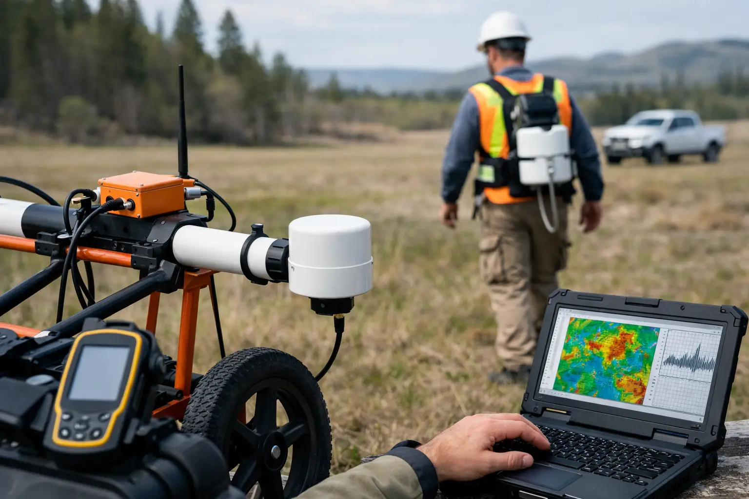
A magnetic anomaly that changes a drilling decision by 200 meters can be worth far more than the survey used to identify it. That is the correct commercial lens for evaluating magnetic survey costs. The objective is not to purchase flight hours or raw total-field readings at the lowest unit price. It is to commission calibrated, traceable geophysical intelligence that reduces uncertainty before capital is committed to drilling, engineering, excavation, or development.
For mining, groundwater, utilities, energy, and infrastructure programs, pricing varies materially because the technical scope varies. A small reconnaissance grid over accessible terrain is not comparable to a low-altitude, terrain-following aeromagnetic survey with ground control, diurnal correction, tie lines, formal QA/QC, and interpreted structural targets. A useful budget therefore starts with the decision the survey must support, then works backward to the data specification.
The Main Drivers of Magnetic Survey Costs
Magnetic survey costs are shaped first by survey geometry. Total area matters, but line spacing, line direction, terrain clearance, and tie-line density often have a larger effect on the final price. Halving line spacing can more than double the number of line kilometers, while also increasing processing volume, mission planning requirements, and field time.
A program intended to identify regional lithological boundaries may tolerate wider line spacing and higher terrain clearance. A program designed to resolve narrow dikes, fault offsets, buried channels, or near-surface ferrous features requires denser sampling and lower, more controlled flight profiles. The latter produces higher-resolution data, but its operational and processing requirements are correspondingly greater.
Terrain is the next major cost variable. Flat, open ground allows efficient line production and predictable battery logistics. Steep wadis, escarpments, active industrial areas, vegetation, overhead obstacles, restricted airspace, and congested corridors introduce flight segmentation, safety controls, alternate launch sites, and additional mobilization. In desert environments, heat, dust, wind windows, and remote access also affect daily production rates. These are not incidental logistics. They determine how reliably a contractor can achieve the specified clearance and line spacing.
Sensor configuration also changes the cost base. A drone-borne scalar magnetometer, navigation system, base station, and real-time flight monitoring package must be selected and integrated for the required detection threshold, altitude control, and operating environment. Projects may also require gradiometry, radiometrics, electromagnetic sensing, LiDAR, or photogrammetry to distinguish magnetic sources from terrain, geology, or cultural interference. Multi-sensor acquisition raises the initial survey cost, yet can reduce the total investigation cost when it prevents separate field campaigns and produces a more constrained interpretation.
Why Area Alone Is a Poor Pricing Metric
Price per square mile can be useful for early screening, but it is not a defensible basis for procurement by itself. It conceals the factors that determine whether the delivered dataset is fit for purpose.
Consider two survey blocks of equal size. The first is an open exploration license with 200-meter line spacing, limited elevation change, and broad regional objectives. The second is a proposed utility corridor requiring 25-meter line spacing, low-level coverage, high positional confidence, obstacle avoidance, and reporting suitable for design coordination. Although the areas are identical, the second project may contain several times more survey line kilometers and a substantially higher risk-control burden.
The same issue applies to minimum project costs. Very small areas can carry a higher unit rate because mobilization, permits, sensor calibration, flight planning, base-station deployment, and reporting must still be completed. For a small pilot, the client is paying to establish an auditable acquisition system, not simply to cover a limited footprint.
The Cost Components That Belong in a Defensible Scope
A complete quotation should separate field acquisition from the technical controls and deliverables that make the data usable. Procurement teams should expect the scope to address at least the following components:
- project planning, risk assessment, access coordination, and regulatory compliance;
- sensor calibration, magnetic compensation where applicable, and base-station operations;
- flight execution, positioning, terrain following, and field QA/QC;
- processing, including diurnal correction, heading correction, leveling, micro-leveling, and filtering;
- maps, gridded data, metadata, quality documentation, and interpreted reporting.
Not every project needs every processing step at the same intensity. However, an apparently low-cost proposal that does not define corrections, acceptance criteria, coordinate reference systems, or data formats should be treated cautiously. Raw magnetic data without transparent processing and quality records can transfer substantial technical risk back to the client team.
Mobilization and field productivity
Mobilization includes the people, equipment, transport, safety systems, and site preparation required to operate efficiently. In remote programs, it may also include communications, accommodation, fuel planning, spare parts, and weather contingencies. These costs are more visible on small surveys, but they remain significant on large projects when operating conditions are demanding.
Field productivity should be evaluated in line kilometers per day, not only aircraft availability. Productive output depends on flight altitude, line length, turns, terrain, airspace constraints, battery cycles, wind, and required repeat lines. A contractor that plans conservative daily output and delivers complete, quality-controlled coverage is generally lower risk than one that bases pricing on optimistic production assumptions.
Data processing and interpretation
Processing is where acquisition becomes decision-grade intelligence. At a minimum, magnetic data commonly require synchronization, spike removal, diurnal correction, positioning validation, line leveling, tie-line adjustment, and gridding. The processing sequence should be documented so that the results are repeatable and auditable.
Interpretation adds another layer of value and should be scoped explicitly. A deliverable may range from corrected magnetic maps to structural lineaments, lithological domains, depth estimates, target ranking, or integrated geological models. For exploration managers, the distinction is critical: a visually attractive map is not the same as an interpreted target package that can guide drilling priorities.
The right level of interpretation depends on available supporting data. Where geology, boreholes, radiometrics, LiDAR, electromagnetic data, or legacy geophysics exist, integrated interpretation can provide materially stronger results than magnetics alone. Where supporting datasets are sparse, a phased approach may be more commercially disciplined: acquire reconnaissance coverage first, then tighten line spacing over anomalies that justify follow-up.
How to Control Cost Without Degrading the Survey
The lowest-cost option is rarely the most economical option. Cost control should focus on eliminating uncertainty in the scope rather than stripping out the controls that protect data quality.
Start by defining the target scale. Specify whether the survey must resolve regional structures, individual intrusions, buried channels, near-surface utilities, or localized ferrous hazards. This determines an appropriate line spacing, sensor altitude, and sampling specification. Over-specifying resolution wastes budget; under-specifying it can require a complete re-survey.
Next, provide accurate boundaries, access information, known hazards, exclusion zones, existing maps, and coordinate requirements during tender. Early access to these inputs lets the survey team calculate realistic line kilometers and mobilization needs rather than carrying broad contingencies.
It is also valuable to separate mandatory deliverables from optional analytical layers. For example, a client may require corrected magnetic grids, flight-line data, QA/QC records, and a technical report as the base package, while retaining 3D inversion, integrated interpretation, or infill coverage as controlled options. This preserves budget visibility without compromising the core acquisition standard.
For extensive programs, pilot surveys are often the most efficient commercial mechanism. A representative pilot validates sensor performance, terrain clearance, cultural noise levels, flight productivity, and processing parameters before full deployment. It can also establish whether the original line spacing is sufficient. This reduces the risk of scaling an unsuitable specification across a large license area or corridor.
Questions to Ask Before Comparing Proposals
A meaningful comparison requires more than a total price. Ask each bidder to state the planned line spacing, tie-line spacing, nominal terrain clearance, expected line kilometers, sensor type, navigation accuracy, base-station method, and daily production assumptions. Require a clear description of the processing workflow and the acceptance criteria used to identify re-flights, leveling errors, positioning gaps, or excessive noise.
The proposal should also define ownership and delivery of source data, corrected line data, grids, maps, metadata, and QA/QC logs. If interpretation is included, request the stated method, assumptions, limitations, and the credentials of the geoscientists responsible for the assessment. This is especially relevant when results will inform resource targeting, engineering routing, or regulatory submissions.
Finally, examine schedule risk. A low bid that depends on unrestricted site access, ideal wind conditions, or a single aircraft with no operational contingency may not support a critical project milestone. The better commercial decision is often the proposal with clear production logic, documented controls, and a delivery plan that can withstand field realities.
Air Solutions approaches magnetic surveys as controlled geospatial programs rather than isolated drone flights. The practical question is not simply what the survey will cost, but what uncertainty it will remove, at what resolution, and with what level of technical confidence. A well-scoped magnetic survey turns budget into a traceable decision asset before the cost of an incorrect field decision multiplies.