فوتوغرامتري
وليدار.
توليد سحب نقاط كثيفة وإنتاج فسيفساء مستوية لمخرجات جاهزة لـ BIM وتخطيط البنية التحتية ومراقبة البناء في جميع أنحاء المملكة. التقاط بدقة سنتيمترية بدقة مطلقة من الدرجة المساحية.
- المستشعر
- Riegl VUX-1 + RGB
- كثافة النقاط
- ~300 نقطة/م²
- الدقة المطلقة
- ±2-5 سم
- ارتفاع الطيران
- 60-120 م فوق الأرض
- التغطية
- ~6 كم²/يوم
التقاط ثلاثي الأبعاد بدقة سنتيمترية من الجو.
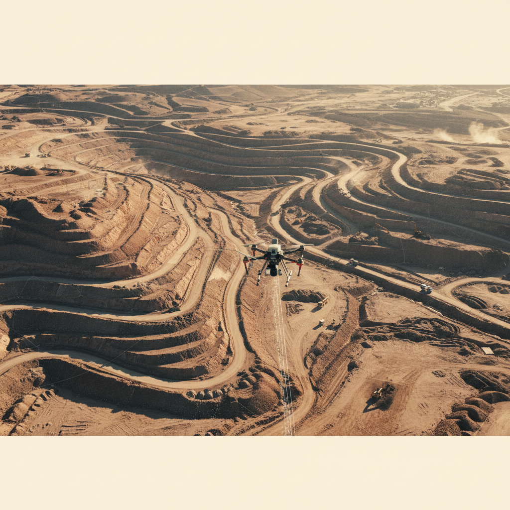
المشاريع العملاقة في المملكة — مدن رؤية 2030، شبكات طرق التعدين، ممرات أنابيب الهيدروكربون — كلها تحتاج إلى نماذج تضاريس يمكن لفرق المسح والمصممين ومقاولي الأعمال الترابية الوثوق بها بدرجة تسامح التصميم. ليدار الطائرات بدون طيار يوفر تلك الدقة بسرعة الطيران، مما يزيل عنق زجاجة GPS-RTK في المواقع الكبيرة أو الخطرة.
نقترن ليدار الموجة الكاملة مع التصوير الفوتوغرامتري المعاير لإنتاج سحب نقاط متراصفة وفسيفساء مستوية ونماذج سطح/تضاريس مصنفة. يُوضع التحكم الأرضي حيث تتطلبه المعايير؛ تُعالج المسارات لاحقاً مقابل محطات مرجعية دائمة.
تُسلَّم المخرجات بصيغة LAS/LAZ لسحب النقاط، GeoTIFF للفسيفساء والصور النقطية، DXF/Shapefile للميزات المتجهة — كلها مختومة بكامل بيانات المعالجة.
سحابة نقاط مصنفة
فئات الأرض والغطاء النباتي والهياكل والضوضاء مفصولة. تُستخدم لاحقاً لاستخراج DTM وحساب الحجوم.
نموذج الأرض العارية
مسار GNSS-PPK ← معايرة boresight ← تعديل الشرائط ← تصنيف الأرض ← نمذجة السطح/التضاريس ← توليد الكنتورات ← تصدير BIM/CAD.
من خطة الطيران إلى نموذج جاهز لـ BIM.
تصميم المهمة ونقاط التحكم
خطة الكتلة، التداخل والارتفاع مضبوطة لمواصفات دقة العميل. نقاط التحكم الأرضي موضوعة ومسوحة بمعيار PPK/RTK.
الالتقاط الجوي
ليدار + RGB يطير على طول الشرائط المخططة. تسجيل مسار PPK مستمر مقابل محطات مرجعية دائمة.
تعديل المسار والشرائط
مسار PPK مُعالج لاحقاً، معايرة boresight، تعديل الشرائط مع نقاط التحكم. التحقق من الدقة المطلقة مقابل نقاط الفحص.
التصنيف والمخرجات
تصنيف سحابة النقاط، استخراج DTM/DSM، توليد الفسيفساء والكنتورات. تصدير بصيغ يحددها العميل.
ما تتلقاه.
سحابة نقاط مصنفة
LAS/LAZ مع فئات ASPRS — أرض، نبات، مباني، ضوضاء.
DTM / DSM
نماذج أرض عارية وسطح بدقة شبكة يحددها العميل.
فسيفساء مستوية
ortho-photo حقيقية مع مرجع جيومكاني مدمج.
متجهات كنتورية
كنتورات رئيسية/ثانوية، خطوط فاصلة، ارتفاعات نقطية — DXF / Shapefile.
تقرير حجمي
حفر/ردم مقابل سطح تصميم العميل مع نطاقات الثقة.
تقرير الدقة + سجل ضمان الجودة
بواقي نقاط الفحص، RMSE لنقاط التحكم، سجل المعالجة الكامل + سجلات المعايرة.
التقط موقعك.
شارك منطقة اهتمامك ومواصفات الدقة وصيغة المخرجات. نرد بخطة مسح وتخطيط نقاط تحكم وجدول زمني خلال 48 ساعة.