الموقع
القصيم وحائل
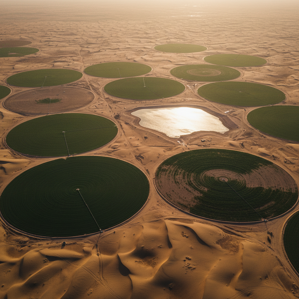
وسط السعودية
العمق المستهدف
0-300 م
خزانات محصورة
الطرق
EM جوي + GPR
متعدد الطرق
السنة
2024
تقرير الحفر سُلِّم
01 · التحدي
معدل آبار جافة مرتفع، خزانات عميقة
02 · المنهج
مسح متكامل EM + GPR
03 · النتيجة
آبار منتجة مستهدفة
كان تحديد مواقع الآبار التقليدي في القصيم وحائل ينتج معدلاً مرتفعاً غير مقبول من الآبار الجافة، مع حمل كل حفر فاشل تكلفة رأسمالية وزمنية كبيرة. احتاج العميل إلى طريقة استهداف قابلة للدفاع ومرتكزة جيوفيزيائياً.
طِرنا مسحاً EM جوياً عبر منطقة الاهتمام لتصوير التوصيلية حتى عمق ~300 م، مدمجاً مع GPR أرضي انتقائي فوق المناطق ذات الأولوية للتنقية الضحلة. عُكست مجموعة البيانات المجمعة في حجم توصيلية 3D مرتبط بسجلات الآبار الموجودة.
كان المخرج تقرير توصية مواقع حفر مرتب — كل موقع مدعوم بنموذج التوصيلية، سمك الخزان المتوقع، وكيل الملوحة، والسياق الهيكلي. حوَّلت فرق حفر العميل التقرير إلى برنامج آبار مياه منتجة.
منتجات بيانات مسلَّمة
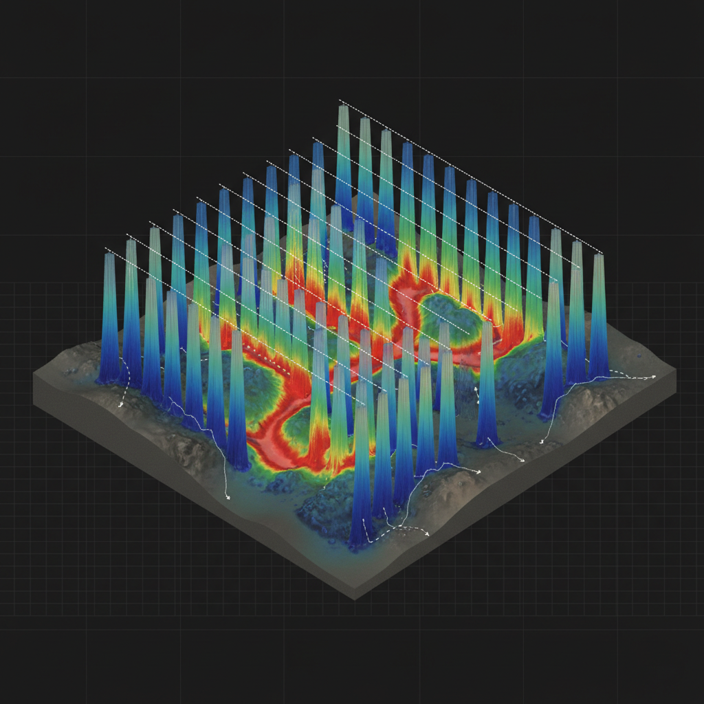
نموذج خزان 3D
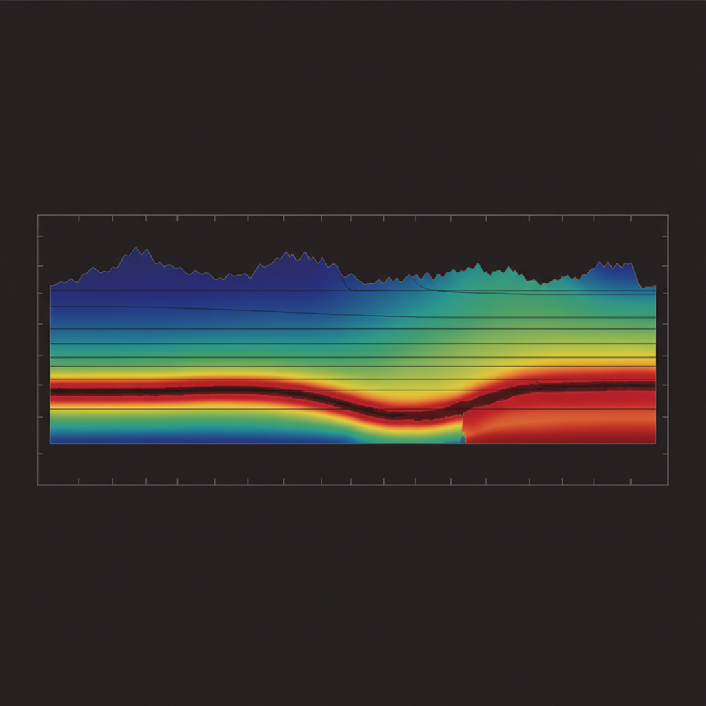
مقطع توصيلية-عمق
المشروع التالي
مسح جبل أشم المعدني ←استهدف خزانك التالي.
شارك منطقة اهتمامك وبيانات الآبار الموجودة. نرد بتصميم المسح وإطار أهداف الحفر خلال 48 ساعة.